Se ha enviado un vínculo para establecer tu contraseña a: Para acceder a tus compras en el futuro, necesitarás una contraseña.
Consigue 3 vídeos o 25 imágenes con una versión de prueba gratuita
Se han añadido nuevos filtros
Ordenar por

75,257 resultados para gps en vídeos

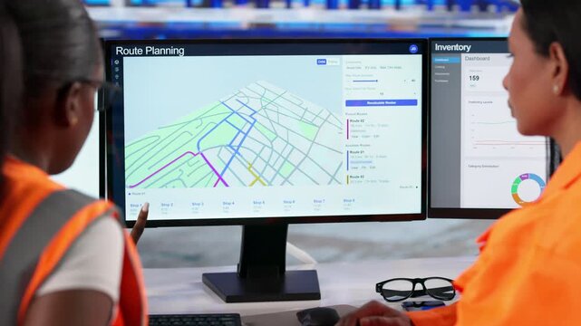
Women Managing Warehouse Logistics
00:32
Alta definición
GPS Turn by Turn Navigation Screen of Simulated Travel
00:46
Alta definición
Satellite navigator gps in car driving
00:29
Alta definición
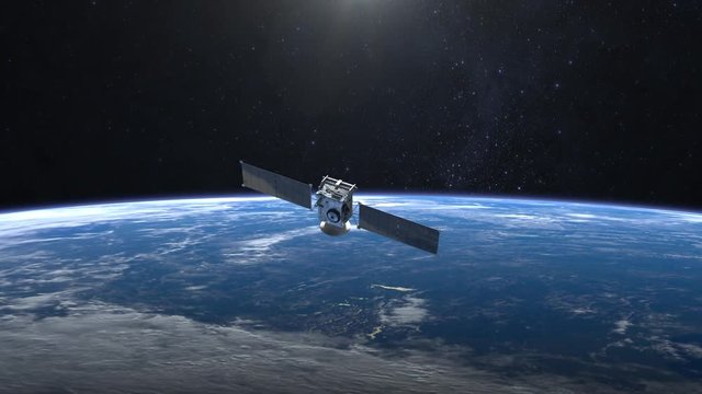
Flying satellite. The satellite appears in the frame and quickly flies away. The earth is spinning rapidly. 4K.
00:15
Alta definición
gps map navigator system animation. route destination 3d city streets. searching direction, track or address. pin location detection. mapping technology and locate position high tech motion background
00:20
Alta definición
4K animation of gps map of Aventure
00:03
Alta definición
Aerial view of city intersection with many cars and GPS navigation system symbols. Autonomous driverless vehicles in city traffic. Future transportation concept
00:20
Alta definición
Digitally mark the position on the map with two pins. gps tracking by coordinates in maps. location point. Generative AI
00:04
Alta definición
location pin animation, map marker icon, navigation pointer effect, gps tracking overlay, alpha channel background
00:10
Alta definición
GPS Navigation, Localization. Seamless loop. 4k, Ultra HD, UHD.
00:12
Alta definición
Ai, surveillance and gps with car on highway from top view for cyber security system, future and technology. Network, safety and radar with vehicle hud tracker in city for digital and database
00:06
Alta definición
Ink reveal animation of San Antonio city, Texas (TX), United States of America, grid map. Aerial top view. Blueprint style. White lines with blue background. 4K Seamless loop.
00:12
Alta definición
City Map With GPS Pins Animation Loop/ 4k animation of an app screen of traveling city map background with gps pins and icons rising
00:16
Alta definición
GPS location pointer animated with radio wave, location pointer, pin icon on black background.
00:10
Alta definición
Security spy program interface. Dynamic modern HUD. GPS location tracking or scanning futuristic software. Marker, indicator moving on the map. Satellite view. Hi-tech. 3D Render 4K animation concept
00:15
Alta definición
Location icons of gps navigation, Global 5g high speed internet connection and Big data analysis process background concept,
00:25
Alta definición
Vibrant red location pin bouncing on smartphone map, highlighting precise gps tracking with digital animation revealing geographical positioning accuracy
00:11
Alta definición
4K UHD Animated city map with location pins and navigation routes. Modern GPS tracking concept for smart city
00:20
Alta definición
gps, location information, network, map, navigation, pinning, drone, aerial view, city, society, sns, pin, spot, tourism, travel, communication, internet, online, web, blue sky, region, area, icon, sy
00:20
Alta definición
Self driving autonomous cars speeding through the bridge with technology scanning their speed. Artificial intelligence traffic surveillance system to provide safe driving avoid traffic jams. 4K aerial
00:09
Alta definición
Communications satellite orbiting planet earth, slowly moving up.
00:15
Alta definición
Aerial view from above of traffic on the elevated expressway with futuristic autonomous, driverless cars using artificial intelligence computer network and satellite gps for navigation
00:20
Alta definición
Navigation app positioning 3d representation of gps city streets. Can be used to represent a self driving car, machine learning or navigator roadmap.
00:24
Alta definición
Person using maps on phone in car to get directions to destination.
00:27
Alta definición
gps map navigator system animation. route destination 3d city streets. searching direction, track or address. pin location detection. mapping technology and locate position high tech motion background
00:10
Alta definición
This is an art GPS map animation for your projects. This is Alstadt
00:12
Alta definición
gps navigation satellite global positioning
00:10
Alta definición
Helicopter shot of self Driving trucks driving on a forest highway with technology assistant tracking information, showing details. Visual effects clip
00:07
Alta definición
Satellite sending signals to Earth. Middle East. Animation of the Earth with bright connections and cities. Aerial, maritime, ground routes and country borders. 2 shots in 1 file. Cyan.
00:30
Alta definición
Phone GPS Navigating on Car Dashboard While Driving on a Sunny Day
00:11
Alta definición
3D GPS Map Navigation Route Red Location Marker city map view featuring a navigation arrow following a route destination pin. for delivery apps, taxi services, travel vlogs, location-tracking concepts
00:20
Alta definición
Location Tracking on a Map on Mobile Smart Phone app
00:08
Alta definición
City Map With GPS Pins Animation Loop/ 4k animation of an app screen of traveling city map background with gps pins and icons rising
00:16
Alta definición
A Dynamic Map with GPS Satellites
00:12
Alta definición
Futuristic security spy program interface. Dynamic modern HUD. GPS location tracking or scanning software. Red marker, indicator moving on map. Satellite view. Hi-tech. 3D Render 4K animation concept
00:15
Alta definición
The man driving a car in the night city. Hyperlapse
00:09
Alta definición
Close up of woman using the navigation system and touchscreen controls inside a car
00:31
Alta definición
3D rendering GPS map navigator with direction path, different color of a route for transport concept, select focus shallow depth of field
00:20
Alta definición
GPS navigation pointer showing destination on digital map route
00:10
Alta definición
Autonomous semi-truck with a trailer, controlled by artificial intelligence, drives over a bridge over the river. Cargo delivery, transportation of the future. Artificial intelligence. Self driving
00:09
Alta definición
Navigation in the phone, get using the gps navigator 48.
00:15
Alta definición
Futuristic digital city map layout with satellite GPS coordinate searching and tracking interface head up display screen with data telemetry information for background display
00:20
Alta definición
Internet Of Vehicles Autonomous Driving Systems Connected Cars Communicating Via Artificial Intelligence With Satellite Beams Information Signals Digital Highway Connection 5G Smart City Traffic Road
00:12
Alta definición
Man using navigation or gps on his smartphone sitting at his desk
00:18
Alta definición
gps map navigator system animation. route destination 3d city streets. searching direction, track or address. pin location detection. mapping technology and locate position high tech motion background
00:20
Alta definición
pin location icon red road map pointer icon for navigation and location pin markers with signal trace animation, animated GPS map location pin. Pop up animation searching location trace
00:13
Alta definición
Traffic surveillance system in highway. Connected network. Speed and identity Control System. Future transportation
00:17
Alta definición
Autonomous Electric Van semi truck car driving on a highway with technology assistant tracking information, showing details. Visual effects clip
00:06
Alta definición
Top view of low poly GPS map of city. Red arrow  running forward along a path. 60fps loopable seamless animation.
00:22
Alta definición
Close up shot of hand operating electronic flight bag in cockpit, EFB
00:06
Alta definición
red map location 3d alpha 4k
00:10
Alta definición
Autonomous Self Driving Car Moving Through City, Overtaking Other Vehicles. Animated Scanning Visualization Concept: Artificial Intelligence Digitalizes and Analyzes Road Ahead. Moving Frontal View
00:10
Alta definición
Map pointer on smartphone screen  local search, delivery tracking and travel planning concept
00:05
Alta definición
GPS location pin icon animation with map marker and navigation pointer on black background.
00:10
Alta definición
GPS location scanning interface. SIM card tracking and following by spy security program. Special data in the corner. Three target dynamic indicators. Satellite map view. 3D render concept animation
00:35
Alta definición
Nanosatellite or nanosat communication global connected tecnology network
00:16
Alta definición
Aerial view of suburban neighborhood with digital map location pins for real estate and property search concepts
00:08
Alta definición
Modern Satellite is Orbiting the Earth on the Sunrise Background, 3d animation.
00:18
Alta definición
GPS navigation and autonomous driverless transportation concept. Aerial view of transport junction with cars and trucks driving with digital green circles, future global technology on roads
00:15
Alta definición
Person using navigation gps in car to travel to destination
00:25
Alta definición
Red location pin pop up on map motion graphic animation
00:06
Alta definición
man uses a gps navigator in the car.
00:17
Alta definición
Futuristic HUD satellite view of traffic surveillance on a busy expressway junctions tracking and monitoring highway traffic for possible target vehicle
00:10
Alta definición
GPS Navigation, Localization. Seamless loop. 3D view. 4k, Ultra HD, UHD.
00:24
Alta definición
gps map navigator system animation. route destination 3d city streets. searching direction, track or address. pin location detection. mapping technology and locate position high tech motion background
00:20
Alta definición
No face unrecognizable man hands driving bus or truck holding steering wheel navigating with gps application in the car with tablet screen computer - view of oncoming highway from inside cabin
00:35
Alta definición
gps map navigator system animation. route destination 3d city streets. searching direction, track or address. pin location detection. mapping technology and locate position high tech motion background
00:09
Alta definición
Animated dashed route line leading to map pin location on white background. Travel path symbol navigation journey graphic element 4k video animation.
00:10
Alta definición
Map pointer icon set with pin symbols for navigation and location markers,on a black background,Tourism and travel concept animation.
00:10
Alta definición
Animated red map location pin with pulsing radar circles on a clean black background, digital navigation, gps tracking, travel apps, and modern user interface
00:12
Alta definición
truck drive through city at night. gps navigation display presents route data. trailer and cab show digital map overlay. urban lights frame road and skyline. truck navigate route live. traffic flows.
00:07
Alta definición
Animated location pin icon on black background, map pointer gps navigation loop.
00:10
Alta definición
Logistics coordinator planning route optimization on digital gps map interface using laptop. Concept of navigation tracking, fleet delivery, and smart transport location.
00:12
Alta definición
High Tech Spy Location Software Tracking Car Path For Secret Mission. Spy Interface. Monitoring Path By GPS Location Analysis. Spy Path Detection Software. Satellite Location Scan Marks Target On Map
00:35
Alta definición
Security spy program interface. Dynamic modern HUD. GPS location tracking or scanning futuristic software. Marker, indicator moving on the map. Satellite view. Hi-tech. 3D Render 4K animation concept
00:15
Alta definición
Aerial city with cars with GPS location icon. GPS tracking analytics. Positioning marker. Digital transformation. Smart city. Future city.
00:07
Alta definición
A smartphone rests on a city street with a navigation map visible and a location pin above, as vehicles drive by during twilight.
00:10
Alta definición
Woman using smartphone gps navigation app in san francisco city
00:17
Alta definición
3D rendering GPS map navigator with direction path, different color of a route for transport concept, select focus shallow depth of field
00:20
Alta definición
Air traffic controller intently monitors flight data on multiple computer screens in a modern control tower.
00:12
Alta definición
The driver of a vehicle using the GPS of his smartphone to navigate in his car. Closeup on the mobile device being used.
00:13
Alta definición
Man uses a navigator in the car.
00:14
Alta definición
Video animation virtual tour on geolocation map and location with GPS aerial top view with point marking on the map tracking
00:20
Alta definición
Program interface tracking person's sim card, satellite surveillance, spyware. Phone tracking, satellite control center
00:29
Alta definición
Satellite. The satellite flies to the right. The earth slowly rotates to the right. 4K.
00:15
Alta definición
Delivery driver checking her phone for gps navigation while driving through the city at night
00:08
Alta definición
Autopilot smart self drive car ride on sunny highway to denstionation point. Technological future animations.
00:13
Alta definición
over gps map location marker floating Luminous high tech circuitry abstract background, representing geospatial navigation and digital tracking video 4k
00:10
Alta definición
Intelligent Vehicles Cars Communicating Ai Logistic Autonomous Delivery Vehicles IoT GPS Tracking Satellite 5G Smart Roads Traffic Road Junction Interchange Motorway Triangulation Of Traffic Data
00:15
Alta definición
Futuristic City Navigation Smart City Network Map Interface glowing points. navigation visuals, GPS technology promos, logistics presentations digital city grid shows tracking nodes infrastructure.
00:20
Alta definición
gps map navigator system animation. route destination 3d city streets. searching direction, track or address. pin location detection. mapping technology and locate position high tech motion background
00:09
Alta definición
Helicopter shot of self Driving trucks driving on a forest highway with technology assistant tracking information, showing details. Visual effects clip
00:07
Alta definición
NASA satellite 01
00:10
Alta definición
Spy scanner tracking the location of the target gps signal on the night map. Gps scanner searching for the criminals location. Gps scanner analyses the specific location on a town map
00:15
Alta definición
Futuristic security spy program interface. Dynamic modern HUD. GPS location tracking or scanning software. Red marker, indicator moving on map. Satellite view. Hi-tech. 3D Render 4K animation concept
00:15
Alta definición
Aerial city with cars with GPS location icon. GPS tracking analytics. Positioning marker. Digital transformation. Smart city. Future city.
00:11
Alta definición
twenty-seven satellites revolve around the earth
00:15
Alta definición
City Map With GPS Pinpoints and Transport Routes Generative AI
00:10
Alta definición
3D Rendering Top view City map with navigator line and destination GPS Technology transportation, Futuristic user interface, HUD Head-up display. Technology and futuristic concept
00:20
Alta definición
Logistics, delivery and transport of goods and parcels by means of transport, van and truck. Aerial view on highway with cars and infographic.
00:24
Alta definición