Videos
Images
Templates
Audio
Customize (Preview)
Pricing
Sell
Main menu
Adobe Stock
Videos
Images
Templates
Audio
Customize (Preview)
Explore plans
All
Images
Videos
Audio
Templates
3D
Free
Premium
My Libraries
Save to Library
Download Preview
...
Save to Library
Download Preview
File #:
574256065
Find Similar
Report Issue
Transparent PNG available
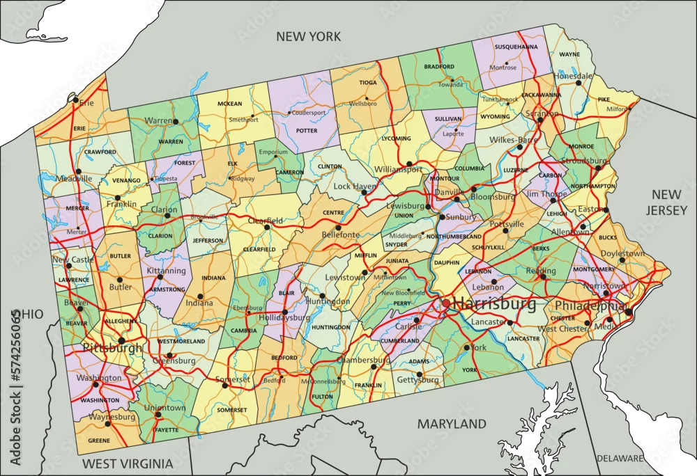
Pennsylvania - Highly detailed editable political map with labeling.
Pennsylvania - Highly detailed editable political map with labeling.
by
pbardocz
FILE TYPE
AI/EPS, JPEG and PNG
CATEGORY
Travel
LICENSE TYPE
Standard
or
Extended
Standard License
(Free trial)
Extended License
(US$79.99)
Download file type:
ai/eps
jpeg
png
Download with free trial
Download with free trial
SIMILAR KEYWORDS
map
pennsylvania
philadelphia
pittsburgh
political
county
state
travel
us
vector
american
atlantic
atlas
background
blue
capital
cartography
city
coloured
commonwealth
continent
contour
country
district
editable
geographic
geography
harrisburg
illustration
interstate
label
land
mapping
national
ocean
outline
pastel
politic
road
sea
shaded
south
territory
topography
town
us
us