Transparent PNG available
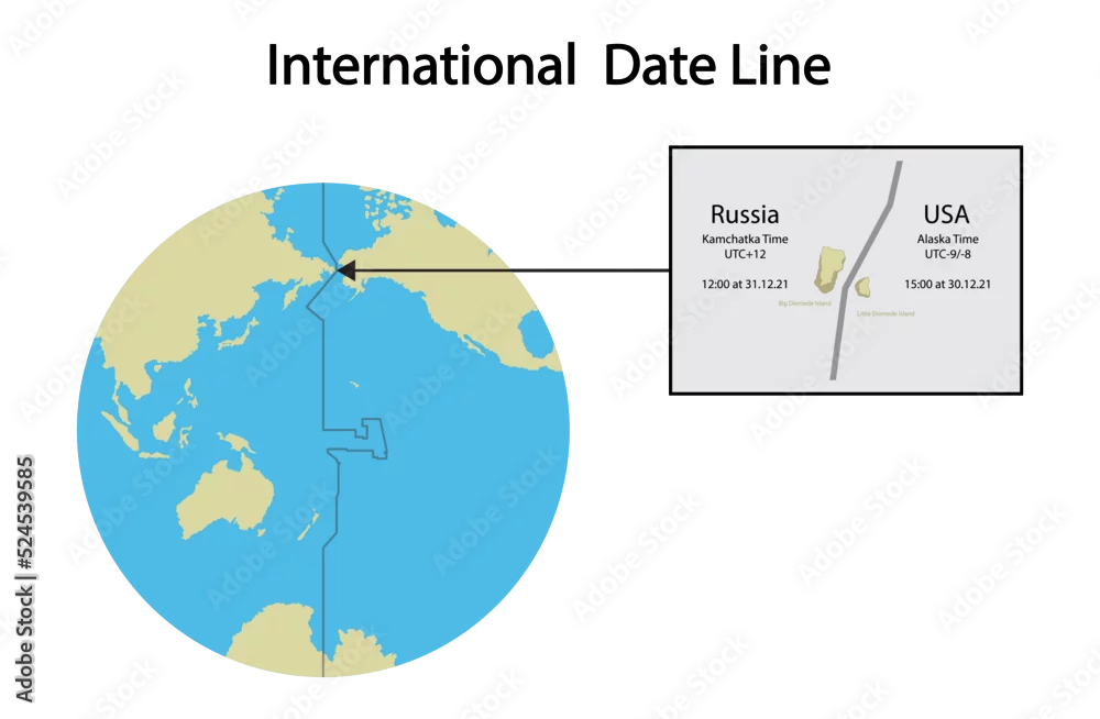
illustration of geography, International Date Line map, line of demarcation, defines the boundary between calendar dates, Crossing the date line eastbound ...
illustration of geography, International Date Line map, line of demarcation, defines the boundary between calendar dates, Crossing the date line eastbound decreases the date by one day
Download file type:
ai/eps
jpeg
png